From 2023 I'm enrolled in a PhD program at the University of Catania.
From 2012 to 2020 I was involved in research and development of new web and geospatial technologies with my startup: Geofunction Srls. Most of my research articles are about Geographical Information Systems and geomatic. My reserch approach is pragmatism grounded and real-world oriented.
You can find my papers on this academic networks:
-
- SCOPUS -
I am a personal and professionals trainer and teacher on these topics:
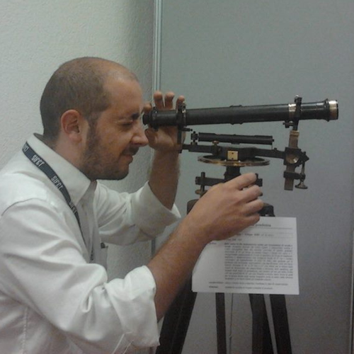
I am a high school teacher, trainer of professionals and companies in my field. I currently work for the promotion of digital and new technologies at the "L. da Vinci" high school in Niscemi (Sicily) and since 2018 I am the Digital Animator and support teacher. I worked as a Topography teacher in the North-East of Italy and Sicily from 2013 to 2018.
My office is open full-time thanks to my collaborators and my business partner in Sicily.
These are some of my main work done in the recent years:
| Year | Title | Description | Contribution |
|---|---|---|---|
| 2023 | Collaudo Tecnico Amministrativo, for a renovation of school building | Construction Quality Controls, building test and administrative check for a school located in Militello V/C - Catania | Full contribution as Civil and Environmental engineer |
| 2022 | Buildings Energy classification and design for zero-emission renovation | Energy demand analysis, and design for some residentials building renovation works in Scily | Full contribution as Civil and Environmental engineer |
| 2021 | Valutazione Incidenza Ambientale per impianto FV 40 MW | Geospatial analysis and risk assessment and impact evaluations for a solar plant in Acate (RG) | Full contribution as GIS analyst and risk assessment expert |
| 2020 | 3D-drone/topography survey in AciBonaccorsi (CT) - Italy | Land survey with drone and topographic instruments for a Green-way design | Land surveyor and CAD/GIS analyst |
| 2019 | Topographic survey in Sutera (CL) - Italy | Topographic and altimetric survey with GPS instrumentation and total station, digital terrain model and 4km-long road sections, serving a sewerage network project | Full contribution as topographer and surveyor |
| 2018 | GIS and Risk analysis for Ancitel Spa | SEVESO III EU directive consult; big-data and GIS analysis on 15 Municipalities in Sicily | Full contribution as expert consultant and gis data-analyst |
| 2017 | Building renovation | Renovation of an old building in Caronno Pertusella (VA) - Italy | Full contribution for design, Construction management, Cadastral upgrade |
| 2015 | Topography survey for Municipality of Niscemi (CL) - Italy | Topography and cadastral cartography upgrade of "area PIP" - Niscemi (CL) - Italy | Full contribution for land surveying, cartography and cadastral upgrade |
| 2010 | Buildings design for Soc. Coop. Euronissena | 21 Terraced houses in Niscemi (CL) - Italy | Partial contribution as structures project consultant, excavation project manager, wastewater network designer |
You can find my coding profile on Github as @gianfrancodp:
| Project Name | Platform/Language | Description | Years |
|---|---|---|---|
| MetPetTools | Python, HTML, Javascript | A collection of Python tools for representing geological data on the web | 2023 to present |
| Qgis RiverBank Tools | Python | Geospatial data science model for hydrology analisys of rivers | 2023 to present |
| StakeOut Assistant | Javascript | Javascript project to convert from cartesian to polar coordinates in topographical surveys | 2024 to present |
| Nixmap for WP | Windows Phone 8 ~ C# | Front End development | 2015-2017 |
| LicataMap | iOS 9 ~ Swift 2 | Project Management | 2018-2019 |
| STATUS | Android ~ Java | Project Management | 2018-2019 |
| Occhiolapp WEB | PHP/MySql/JS/CSS/HTML | Full stack development | 2017-2018 |
| Description | Date | Issuer |
|---|---|---|
| NASA OpenScience ~ Python (Programming Language) and Git | October 29, 2024 | NASA Transform to Open Science |
| Hyperspectral Thermal Image Unmixing | February 4, 2020 | GEO University |
| The Network Based Method Spectral Unmixing Framework | February, 4, 2020 | GEO University |
| A Machine learning approach for Object Parameter Estimation and Discrimination Using Hyperspectral Data | February, 4, 2020 | GEO University |
| Learn Hyperspectral Remote Sensing from the Scratch | February, 4, 2020 | GEO University |